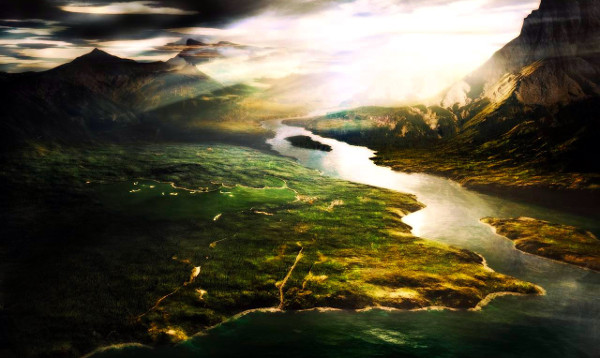
Geography of Mythania
Over 24,000 miles in circumference with 50,000,000 square miles of dry land, the world of Mythania is a big place. From the frozen poles and arctic tundras to the tropical forests of Azania and desert plains of Tarrona, to the impassible mountains of the Shanalyean, the geography of the world is as varied and vast as can be imagined. There are rivers and lakes, oceans and seas, mountains and deserts, jungles and glaciers. It would take 100 volumes of texts to catalog and describe every detail of every geographically significant place. Nevertheless, this section will attempt to highlight and summarize the most significant places.
Celaphania
The great continent of Celaphania is the largest continent and the heart of civilization, yet the Azanian Jungles and Tundral Waste remain largely unexplored. Celaphania is divided into three subcontinents: Celania in the north, Mesoria in the southeast, and Zhonghua in the southwest. The Shanalyean begin where all three land masses come together; north of the Shanalyean is the impenetrable Azanian Jungle.Celania
The subcontinent of Celania has four large nations: Pertha, Norithia, Glaven, and, of course, Armillia. Armillia and Norithia are separated by the Pyridine Mountains and the Medrean Sea lies south of both. The more northern Sirean Sea is connected to the Medrean through the Strait of Turan. In the Midlands of Celania lies the fertile Azanian Basin. Here flows the Mighty Azanian, feeding the Azanian Jungle. East of the Azanian, in the coastal areas of the Medrean and south of Pertha and Norithia, is the ancient kingdom of Glaven. North of Glaven is the Sirean Sea, to its east the Medrean, and to the south is the Tulsan Sea. Glaven forms the northern tip of the Strait of Goela (Cylinica being the southern tip). In the northwest lies the Tundral Waste.
Medrean Sea
From the ancient times of Elinica to the great Imperial Republic to the modern golden age of Armillia, the Medrean has been bustling with trade, commerce, piracy, and war. This one area of the world has such a history that the Academy of Glaven has an entire wing of its library dedicated to the Medrean alone. The Medrean Nations are those whose coasts line the Medrean, which accounts for seven of the nations of Celaphania including Armillia, Glaven, and Crethia. Over the centuries, the countries around the Medrean have numbered anywhere between one to over a dozen independent nations. But never once, not even during the darkest of ages, has civilization on the Medrean died away. Whether plagued by barbarian pirate ships or graced by great Kaffrian merchant galleys, the Medrean has been and will forever be the heart and soul of civilization.
Tulsan Sea
The Tulsan Sea is a small sea off the Medrean, located just to the west beyond the Strait of Goela. A peninsula of Glaven forms the northern tip of the Strait of Goela, with part of Cylinica forming the southern tip. Like the Medrean, and being connected directly to it, the Tulsan Sea has also been a major center of trade and commerce. Hundreds of port cities dot the coast of Glaven and Crethia, though both nations have countless cities on their Medrean coasts, as well.
Sirean Sea
Another small sea just off the Medrean is the Sirean Sea, located in the northern part of Celania. The Sirean Sea is connected to the Medrean through the Mallisan Passage. There are fewer islands in the Sirean Sea than in other seas, as well as less commerce. However, several major port cities exist on the shores of the Sirean, including Ogalos, the capital of Norithia.
Pyridine Mountains
The Pyridine Mountains mark the border between Armillia and Norithia. Located to the northwest of Armillia (or southeast of Norithia), the Pyridines are a towering range of snow-capped mountains. The mountains are considered wild-country and are fairly treacherous; therefore most travel between Armillia and Norithia is over sea (or now by air), though there are several passages through the mountains that are relatively safe for travelers. Many bandits, goblins, and barbarian people live in the mountains, preying upon those who wander from the more frequented trails. In the more remote regions of the Pyridines there live arctic dragons and other magical beasts.
The Jungle of Azania
The Midlands of Celaphania have long been a place of mystery and legend. Technically part of both Celania and Mesoria, the Midlands bridge together the three subcontinents of Celaphania. Most of the Midlands consist of jungles, swamps, wetlands, and dense forests, collectively called the Azanian Jungle. The great Azanian River feeds this entire land, running the Shanalyean Mountains and emptying into the Bay of Arkana. The Azanian Delta is one of the most tropical and lush rain forests in the world. The north western region of the Azanian Jungle (Azcan) consists of tropical and subtropical forests and deep rainforest, while the south eastern region (Punta) is has much thicker vegetation and remains virtually unexplore. East of the Azanian Jungle, in Antilla, are lighter forests, rich plains, and golden savannas.
However, the demon Nightloch and the war against his minions decimated the Azanian Jungle. A large swath of the Azanian Jungle has been reduced to lifeless thickets, putrid swamps, and ruins, now collectively referred to as the Bloodlands of Azania (or simple the Bloodlands). Countless monsters, unnatural beasts, and magical creatures spawned from that dark war still roam the hunted swamps and twisted thickets, and may be encountered by anyone fool enough to enter. On occasion these creatures have left their lairs and encroached upon the human world, plaguing Cylinica, Crethia, and Arkana. It may take centuries for the Azanian Jungle to recover, but it will eventually recover. The great Azanian has survived all the wars and calamities that have plagued the world, from the God Wars to the War of Golla and Marada.
The Tundral Waste
The Barrier Mountains mark the border between Pertha and the Tundral Waste--a great stretch of cold arctic plains taking up the northwestern quarter of Celania. The northern quarter of the Tundral Waste is mostly covered by the arctic ice cap, while glaciers extend further south. The tundra plains extend to the north shores of the Sea of Nanshin, where hundreds of Indigenous tribes live in small fishing villages. The Tundral Waste remains largely unexplored.
Maradian ruins have been discovered on the warmer southern coast of the Tundral Waste. It is quite possible that more exist further in, but no one has yet ventured deeper into the arctic region.
Mesoria
There are eight nations in Mesoria: Crethia, Cylinica, and Panora border the Medrean, while on the eastern coast is Freyor, its coastline along the Sea of Isles, and southward are Arkana and Antilla. Turning back inward along the coast of the Marisian Sea are the underdeveloped jungle nations of Azcan and Punta. Mesoria is, for the most part, a fertile land with only a few deserts and dry plains in the center of the land mass. Most of central Mesoria lies in the Azanian River Basin, fed by the Great Azanian River and the many small rivulets leading into the Azanian. Here nomadic tribes of primitive humans, Marsids, and gantuans have settled. But such close proximity to each other has caused a great deal of strife and tension throughout the nations of Mesoria, especially Azcan, Punta, and Antilla. The Kaffrian Empire once ruled Azcan and Antilla. Though the Kaffrians still maintain a strong presence in these regions, humans have become dominant. The ruins of the great Kaffrian pyramids and sphinxes can still be found dotted throughout most of southern Mesoria.
Marinus Subterraneous
The Subterranean Sea, as it is more often called, is claimed by Crethians to be "the Greatest Wonder on Earth". The Marinus Subterraneous has also been called the Dark Sea, the Nether Sea, the Sea of the Dead, and similar names that imply the underground sea and river may lead to a netherworld. This underground sea is part of a larger system of caves (collectively called the Marinus Subterraneous), and at least three rivers and two smaller lakes have been found that may interconnect through underwater passages and caverns. The cave system is at least as large as the Caverns of Taldan in Leleka, but only a fraction of the system has been explored.
The largest and most famous part of the Marinus Subterraneous is, of course, the Subterranean Sea. The sea is directly accessible through one of many cavern entrances, and the shortest one winds half a mile through fairly easy going tunnels, well marked and lit by torches or oil lanterns. A number of locals have made a living leading tours through the well-explored areas. Standing on the banks of the Subterranean Sea, it is virtually impossible to gauge the cavern's proportions. There is a small dock and numerous boats in a various state of disrepair on the bank. As for its depths--that remains a mystery. Very few have dared to swim in the water, and only one man is known to have dived down into the black depths. He survived and claimed to have gone down forty feet without touching bottom. The lake is plentiful with fish, all apparently blind, and other creatures such as crawfish, water-worms, and eels. The fish (and sometimes the other creatures) are caught and sold in nearby markets as curiosities and exotic food items.
The Crethian government technically owns the Marinus Subterraneous, but, being in a remote region, they do not regulate the caverns to any extent. The army does patrol the area occasionally, but only to make sure there are no criminals or revolutionaries hiding out. Some 90% of the caverns remain unexplored; deep and vast as they are, the caverns are not likely to surrender their secrets easily.
Zhonghua
The southwestern subcontinent of Celaphania is known as Zhonghua. Zhonghua is separated from Azania and Mesoria by the near-impassible Shanalyean Mountains. In the mountainous region of Shanalyea is the nation of Kohaea. South of Kohaea is the brutal empire of Kangoa. In the center of Zhonghua lies Sinoa, and south is the small nation of Taona. The entire western half of Zhonghua is controlled by the powerful and mysterious Kingdom of Tai-tsing. North of Tai-tsing is the Sea of Nanshin, where lies the island-nation of Nanshin.
The Great Shanalyean Mountains
The nearly impenetrable Shanalyean mountain range is the greatest range of mountains in the world. It stretches from the western coastal cliffs of the Sea of Nanshin all the way to the low lands of the Azanian River Basin, and deep into the subcontinent of Zhonghua. In this region mountains tower over 10,000 feet, and even the "lowlands" of the Shanalyean can be as high as 3,000feet above sea level. Though it is an equatorial region, temperatures are mild in the summer and frigid in the winter because of the altitude.
Travel through Shanalyean is extremely difficult, even in the summer. There are only a few passes, the major one being along the eastern coast, and it can take nearly a month to make this journey. However, the eastern portion of Shanalyean is controlled by the barbaric Kangoans, and they do not take well to trespassers. Other mountain passes lead through Kohaea, an agrarian society of sheep and goat herders.
Legend tells that when the goddess Xin-Feng returned to Zhonghua centuries after the Second God War, she created the Shanalyean Mountains to protect her lands from the barbaric people who then inhabited the rest of Celaphania. Whether or not this is true is a matter of faith.
The Sea of Isles
The Sea of Isles is the ocean between Celaphania and Tarrona, about 5,000 miles across at the equator. This ocean is dotted with thousands of islands, most of them uncharted. These include the pirate-kingdom of Sculdoria, the wealthy island of Nuram, the Corel and Tropical Archipelagos, and many other islands. Primitive tribes inhabit most of the islands. The island/continent Tricar is at the northern part of the Sea of Isles.The Corel Archipelagos
The Corel Archipelagos lie off the eastern coast of Mesoria, a few hundred miles east of Panora. The Corel Archipelagos are controlled by the Armillia, Panora, and Freyor; each nation governs several dozen islands. The islands are used as ports of call for ships traveling across the Sea of Isles, as well as forts and naval bases.
The Tropical Archipelagos
The Tropical Archipelagos lie a few hundred miles off the western coast of Tarrona. The Tropical Archipelagos span a greater area than the Corel Archipelagos and are for the most part independent. A few of the islands are controlled by Tilsha and used as ports, but the rest are either self-governed states or populated by island tribes. Some of the islands are completely uninhabited, though many of these may be used by pirates.
Sculdoria
The island of Sculdoria lies just north of the equator, nearly centered in the Sea of Isles. It is about 400 miles east to west, and the interior is comprised of mostly tropical rain forests with scattered mountains (extinct volcanoes). Sculdoria is most notable for its lack of government and wicked cities that harbor the pirates, slavers, and marauders who terrorize the Sea of Isles.
Tricar
Tricar is the large island in the north of the Sea of Isles. It is the homeland of the triclopes and the sole remaining remnant of the Tricarian Empire. The island is largely unexplored by humans, but the island is thought to be geographically unremarkable. There are some mountains in the north of Tricar as well as in the south rivers, forests, and plains. Though Tricar is near the arctic circle, thanks to ocean currents, the island is as temperate as southern Armillia most of the year.
Nuram
Like many islands, Nuram was created by volcanism, and its largest feature is a mountainous, ever-smoking volcano (Novanus) that dominates the entire western half of the island. The volcano has only erupted once in written history (due to over-mining), but it is still an active volcano, venting hot gasses and lava, with minor "sputters" from time to time. The volcano is believed to be extremely deep, and below the lava cap is a lava-filled chasm that leads deep into the earth, perhaps even to the very core of the planet. During quakes and minor eruptions, rocks from the bowels of the earth are forced up and expelled, or logged in cavities deep within the volcano. Some of these rocks contain a special mineral called Novarite, which has a very special property--it pushes itself away from the earth, rather than being attracted to it. Stones from Novanus possess this mineral in varying quantities, but some rocks have a high-enough concentration to float. Today, Nuram is controlled by the Dworghen Kingdom (the Novanus Mercantile), who mine and refine the precious ore.
Tarrona
Tarrona is the second-largest continent in the world. There are sixteen recognized nations on Tarrona, but dozens more barbarian nations are located in the frozen north and speckled throughout the Carsovian Mountains. Terrona is about 3,600 miles across from east to west. There are four distinct political regions: the Dark Kingdoms in the north, the Desert Kingdoms in the southeast, the Commonwealth Kingdoms in the west, and the Barbarian Kingdoms of the far north.The Carsovian Mountains
In the center of Tarrona, splitting north from south and east from west, are the prodigious Carsovian Mountains. Ranging nearly 1,000 miles from north to south and 800 miles at their widest, the Carsovians are second only to the Shanalyeans in scale. It is here, in this forbidding region, that the Kingdom of Darmania arose. Nestled in the western steppes of Carsovia is the war-torn kingdom of Phana, the unfortunate victim of untold millennia of conflict. In north Phana, near the the western Carsovians, just east of the Cassetian Mountains, are the haunted battle fields of Moytura where in ancient times the Eldrien and Scaithi clashed, forever dividing Tarrona between the Kingdoms of Light and Darkness--or so the legends tell.
Since the dark age after Marada the Carsovians have been a battleground between warring factions of Vampires and Warlocks, and the peasant people living here have paid the ultimate price. The Senti people native to the region were long ago displaced, though many still remain and struggle to survive in the shadow these evil mountains cast. With the formation of the Grand Imperium, the Vampire and Warlock feud has drawn to an uneasy peace. Both factions have turned their hateful gaze south, and have joined their dark legions with the armies of Kendes and Kaldea in a common cause.
The Mountains of Fire and Ice
Farther north than the Carsovians lie the frigid Mountains of Fire and Ice. This stretch of mountains marks the beginning of the arctic tundra of Tarrona, beyond which begins the polar ice sheet. These mountains are volcanic, and though there have been few recent eruptions, some continue to smolder. The combination of smoldering volcanoes skirted by great glacial walls is both an awesome and terrifying sight. The region is home to countless bands of nomads and war tribes, both human and ogre. Giants also live in the mountains, but being solitary by nature are far less a threat than the marauding war-bands. Recently, the Grand Imperium has managed to bring some measure of order to the far northern lands of Tarrona; due to this, many war-chiefs have allied themselves to Kendes and Kaldea. Barbarians, ogres, giants, and goblins have now joined the ranks of the Imperial army as irregular soldiers and mercenaries.
The Wastelands
The Wasteland of eastern Tarrona is a vast expanse of hostile desert. But this is a desert where there should not be a desert; the climate is mild, the soil is rich, and the area receives adequate rainfall. Indeed, before the War of Golla and Marada, this region was among the most fertile areas of Tarrona. It was here, however, that Marada constructed a massive weapon to be used against Golla. Though details of this weapon are obscure, there is little question that the weapon (or its destruction) is responsible for the condition of the Wastelands.
To this day, no one who enters the Wastelands can hope to survive. There have always been independent explorers and treasure seekers who believe they can brave the dangers of the Wastelands, but few return. Those who do make it back are afflicted with a horrible disease known as the Burning Sickness, an illness of which Maradian records also give account. Symptoms of the Burning Sickness include burns and rashes not caused by fire or chemicals, blindness, excruciating pain, the loss of hair and fingernails, and eventual death. Nothing seems to protect from the Burning Sickness--knights have gone in fully armored and still perished. For this reason, the Wastelands remain unexplored.
Over the past 500 years, the Wastelands have receded by about 200 miles along both the River Kindra and the eastern coastline. Since the days of Antaria, the River Kindra has been clean from the poisons that infects the land. Bold explorers have shown that it is safe for humans to venture another 100 miles or so, but beyond this point the region becomes too poisonous for any life to survive. It is hoped that the Wastelands will continue to recede, and that in perhaps another 500 years will be as lush and fertile as it was a millennia ago.
The River Kindra
The River Kindra is one of three major rivers in Tarrona, the other two being the Falkshire River and the River Tamasee in the west. The River Kindra runs south out of Kaldea, skirting the Wastelands to the great delta of Ostarh, where it empties into the Vast Sea. For several hundred years after the War of Golla and Marada, the River Kindra was as poisoned as the Wastelands, but as time passed the Wastelands began to recede. Civilization returned to the region and the Kingdom of Antaria flourished on the banks of the Kindra until the War of Tyranny. The Kingdom of Ostarh now rests where Antaria once stood, and most of Ostarh's major cities lie along the Kindra, including the capital, Jal'teirr, which rests at the fertile delta.
The Falkshire Mountains
Markedly more pleasant than the foreboding Carsovian Mountains, the sylvan Falkshires are smaller, yet more majestic. The tallest mountains are snow capped in the winter, but these caps melt in summer to feed the rivers that flow through the Ruballi and Suddaean deserts, bringing much-needed water to those arid lands. The Falkshires themselves are of a mild and wet climate, marking the passage of the eastern scrubland to the western woodlands of Bryland. The Falkshires are also home to many Eldrien tribes, and some credit the strikingly pleasant climate to their magic.
The Suddaean Desert
The Suddaean Desert fills most of the southeast quarter of the continent of Tarrona. The Suddaean desert has remained relatively unchanged throughout recorded history. In spite of its inhospitable climate, there are rivers and oases to be found; it is around these rivers and oases that human settlements first formed. The desert has been mined for gold, silver, and precious stones for centuries, but only recently has oil been discovered here. The Suddaeans perfected the alchemical techniques of transmuting common oil to ichor. Ichor has come to replace wood and coal more prevalently as the driving fuel for ships and industry. Since 1000 CA, Suddaea has increased its wealth ten fold from the exportation of ichor and grown from an insignificant kingdom to a true world power.
The Stone Valley of Kharam
The Kingdom of Kharam is mostly a vast desert on the eastern extent of the Suddaean, marked by the occasional oasis or rivers upon which towns and villages have been built. Deep into this unforgiving wilderness lies one of nature's most awesome and unique wonders: the Stone Valley (also known as "Valley of Stones"). The river e'Haptmur, which comes down from the distant northern mountains separating Kharam from Ostarh, appears to have carved out much of the valley, although wind and geological activity probably shared an equal part in its creation.
The most immediate feature of the Stone Valley is the Canyon of the Sun, through which runs the e'Haptmur during the "wet" season (the rest of the year it is dry). As impressive as the canyon is with its wind-carved towers of stone, rainbow-colored rock faces, and wide-open expanses, this is not the most remarkable place of interest. Throughout the region are countless hot water springs, geysers, and towering petrified mineral deposits. Most of the springs are not suitable for bathers; the springs are quite toxic, not to mention that the water is so hot it could kill a man. However, the springs are quite beautiful, coming in a variety of colors from deep blue, to green, to yellow and red. Bubbling-hot mud pits are also common throughout the area. Corundum crystals are abundant here, and may of the rocks contain these valuable crystals inside. There are many other interesting rock formations, as well as caverns to explore.
It was not until recently that humans began to frequent the Stone Valley. Before 900 CA, the Stone Valley was the lair of an old desert dragon. A number of heroes attempted to slay the dragon, but all failed. The last hero to enter the region, a mercenary of modest repute, returned with the dragon's head. There are suspicions, however, that the great dragon simply died of age, and that the mercenary did nothing more than cut off its head and bring it back. Nevertheless, hostile creatures were cleared out of the area within a few short years; the first village was built in 960 CA. Since that time, the area has grown considerably and is regularly visited by adventurers and scientists alike. Another one of the more notable features of the area is the body of the great dragon, preserved (rather crudely) and on display in the newly built Stone Valley Museum.
Caverns of Taldan
The Caverns of Taldan are located in the wet lowlands of central Leleka, southwest of the Cassetian Mountains in a region known as Taldan. Here, and throughout an area spanning about 400 miles, are numerous sinkholes, caves, and deep caverns. Most of the sinkholes are a few hundred feet deep and perhaps 100 feet across, and are so old they are now filled with vegetation and trees. A few are newer, some having formed only a few hundred years ago. It is thought that the sinkholes formed because ancient underground rivers may have chewed out the limestone bedrock of the region. The earth is also unstable; minor earthquakes are frequent in the area. A large quake will sometimes cause an already weakened cavern to collapse. Afterward, the holes will either fill with water or, if drained by smaller caverns and tunnels, eventually fill with vegetation and, later, birds and animals.
The 400-mile area of sinkholes is remarkable enough to make this place a natural wonder, but it is also the largest-known underground cavern system in the world (Crethians claim their Marinus Subterraneous is larger, but the truth is that no one has explored either cave system in its entirety). It is believed that only ten percent of the caverns have been explored, and the cavern system may run as deep into the ground as two miles. At least 100 people have vanished over the past 50 years exploring the caves, and though they might have simply gotten lost, there are many who believe the deepest reaches of the caves lead to the Netherworld. Reports of ghosts and specters are unusually high in nearby villages (higher than other Lelekan villages, at least), and floating spots and strange colors are often seen in and around the sinkholes before or after a minor quake. Superstitions, stories, and legends about the Caverns of Taldan are thick and plentiful in Leleka, and the place remains a national icon.
Megonia
Megonia is a large island-continent and home to four nations: Corrithia, Marres, Gerank, and Sodes, all in a state of constant war with one another. Marres, Gerank, and Sodes are considered "barbarian" kingdoms, ruled by the dominant tribal warlord. Corrithia, however, developed into a much more civilized state after the War of Tyranny. An ally of Tilsha and Suddaea, Corrithia established a formidable military to keep at bay their warlike neighbors. Early in the 1030s CA, however, Kaldea began supplying Corrithia's enemies with weapons and mercenaries, and in 1037 the Kingdom of Corrithia was overrun and destroyed.The Vast Sea
The Vast Sea is an enormous ocean, being about 8,000 miles wide at the equator between Tarrona and Zhonghua. It was long considered to be uncrossable by naval ship and airship alike due to its tremendous width and lack of charted islands. Though today modern steamships could make the attempt, there is little need to do so. With trade routes firmly established between Tarrona and Celaphania across the Sea of Isles, there is no economic need to risk charting routes across the Vast Sea.The Frozen Continent
The Frozen Continent, in the south antarctic region, remains the largest unexplored landmass in the world. It is too cold for civilization, but the occasional adventurer comes to this land seeking mythical artifacts and lost civilizations. Many who return claim to have seen great cities and awesome ruins frozen in the great glaciers. This has led some scholars to believe the world may have been warmer at one time, or possibly that the continents may have once been further north. However, such rumors of ancient frozen cities are unsubstantiated.


